NT experts put new satellite research into context
When new scientific studies emerge about the Northern Territory’s groundwater systems, our scientists step up to investigate the findings and integrate what’s useful into our growing knowledge base. The recent paper by Ndehedehe et al., which used satellite data to suggest the Cambrian Limestone Aquifer (CLA) is drying out, prompted exactly that kind of collaborative scientific response.
Understanding the CLA
The CLA is one of Australia’s largest groundwater systems — a vast and complex network of aquifers stretching across about 570,000 square kilometres, roughly the size of France and includes the Daly, Georgina and Wiso basins. Each basin has unique groundwater characteristics, from water levels, storage, yield and quality to recharge patterns.
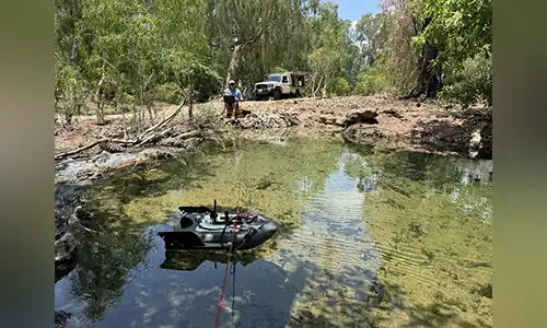
Over decades, NT Government scientists have built a detailed understanding of this system through fieldwork, drilling data and continuous monitoring. These insights support water allocation plans for key regions including Katherine, Oolloo, Mataranka and Georgina–Wiso, ensuring water use remains sustainable. We continuously build on that understanding as new information from a range of sources becomes available.
Science through collaboration
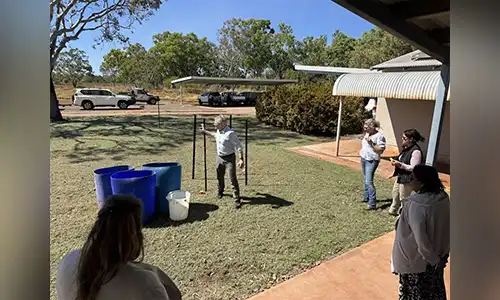
The Department’s hydrogeologists work closely with experts from the Bureau of Meteorology, CSIRO, Geoscience Australia, universities, consultants and licensed drillers to understand the characteristics of the CLA and how it responds to climatic variation and the impact of water take. Our scientists analyse data from nearly 5,000 bores, 117 continuous monitoring sites, dozens of surface water locations and incorporated this into peer reviewed water resource assessments. This information feeds into integrated models that assess how the aquifer responds to rainfall, drought and water use.
Interpreting new satellite data
The GRACE (Gravity Recovery and Climate Experiment) satellites measure changes in gravity to estimate total water storage. While GRACE data are useful for tracking broad, long-term trends, they can’t isolate local groundwater changes or distinguish between natural variation and human impacts.
When our scientists compared GRACE data with Bureau of Meteorology rainfall records and long-term monitoring results, they found that the apparent “drying trend” identified by Ndehedehe mostly reflected naturally oscillating climate cycles. Record wet conditions in 2010–2012 left groundwater levels unusually high, followed by several dry years that reduced storage.
Our scientists have reviewed more recent GRACE data that shows water levels have recovered to record highs after rainfall events in 2022 to 2024. We are confident that the CLA is not drying up but follows natural cycles.
Continual learning and improvement
The department welcomes new research as part of its ongoing commitment to evidence-based water management. New technology adds to the conversation and helps refine monitoring and modelling approaches. Our scientists regularly review and recalibrate groundwater models as part of five-year water allocation plan updates.
By combining local expertise, long-term monitoring and national scientific collaboration, the NT continues to build a clear and confident picture of its groundwater resources — ensuring decisions are guided by robust, transparent science.
Find out more
Download a copy of our factsheet on Water Resources within the Cambrian Limestone Aquifer
Recent studies that inform the Department’s work on the Mataranka Water Allocation Plan include:
- Daly Basin Groundwater Resources Assessment – North Mataranka to Daly Waters (Tech. Report 20/2015D)
- Strategic Regional Environmental and Baseline Assessment for the Beetaloo Sub-basin (Tech. Report 41/2022)
- Hydrogeological assessment of the Cambrian Limestone Aquifer and the Dook Creek Aquifer (CSIRO 2024)
- Upgrade of the Coupled Model of the Cambrian Limestone Aquifer and Roper River Systems (Tech. Report 57/2020)
Full lists of supporting reports and plans are available at:
nt.gov.au/environment/water/management-security/water-management