Groundwater dependent vegetation mapped in Berry Springs Water Allocation Plan area
The Berry Springs Water Allocation Plan was developed to manage the Berry Springs Dolostone Aquifer over an area of 105 km2 area within the Darwin Rural Water Control District, to help ensure that water management meets the needs of stakeholders and connected communities in a sustainable way with a sustainable balance of economic, ecologic, and cultural considerations.
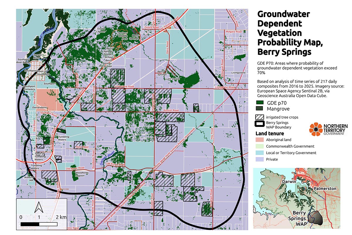
One priority in this process is assessing the location and extent of groundwater dependent vegetation (GDV), which is foundational to groundwater dependent ecosystems (GDEs).
We identified GDV areas in the Berry Springs WAP area through an analysis of a time series of satellite imagery, verified at over 140 sites by independent specialists to establish the presence or absence of known groundwater dependent trees.
The analysis consisted of 217 cloud-free image composites of the area over an 8-year period (2015 to 2023) to track vegetation indices for every pixel in the images.
We found that most vegetation followed rainfall patterns, and our analysis also identified those pixels whose patterns deviated from the dominant rainfall-driven pattern. Pixels that stayed greener for longer than the rainfed pixels are assumed to access another source of water.
In Berry Springs, that includes mangroves, irrigated vegetation, and vegetation accessing groundwater. By excluding the first two categories we isolated the remaining pixels that were accessing groundwater.
This was corroborated with a statistical comparison of the field verification sites to produce a probability of GDV; all areas that were above 50% and 70% probability were marked and presented in the P50 and P70 maps, respectively.
These maps are available at NR-Maps and described in greater detail on Territory Stories.