Sharing innovative ways to protect the Northern Territory’s water resources
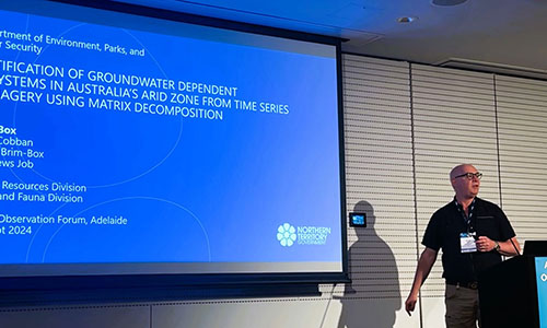
Water Resources Division unveils innovative work that uses advanced satellite data and machine learning to detect groundwater-dependent ecosystems (GDE) at the Advancing Earth Observation Forum 10-12 September 2024 in Adelaide.
This provides a method for mapping probability of GDE using remotely sensed data across our vast landscape and presents the Territory’s achievements in machine learning and matrix modelling.
Last month Water Resources staff were in Adelaide presenting on the novel method developed to detect groundwater-dependent ecosystems (GDEs) in humid Top End systems and in the dry Arid Zone.
This was a part of the Advancing Earth Observation Forum 2024, which focussed on advancements in Earth observation (EO) technology in Australia, and how artificial intelligence (AI) and machine learning are transforming the analysis of satellite data, to support climate adaptation, disaster preparedness, and sustainable development.
Dr Paul Box, senior scientist, delivered a presentation on using satellite data from Digital Earth Australia’s open data cube to model components of variance in Normalized Difference Vegetation Index (NDVI) imagery using Singular Value Decomposition. This method detects vegetation that stays green even in dry conditions, signalling its reliance on groundwater, and can also detect vegetation that is partially accessing groundwater after the wet season ends. The multi-dimensional data intensive approach generated a lot of interest from the other participants and provided an important platform to test ideas and receive feedback from professionals across the sector.
Mathews Job, graduate data scientist, presented on using artificial intelligence (AI) and data mining techniques, including developing an application for vegetation recognition of tree species. This approach trains a model to automate the vegetation classification process, enabling large-scale and efficient monitoring of vegetation rather than traditional labour-intensive methods of classifying tree species through fieldwork. Fellow data scientists discussed pattern-recognition and shared difficulties of finding datasets for unique Territory vegetation types.
The forum provided a platform for Water Resources to showcase cutting-edge research and learn about the latest advancements in Earth observation technologies and from leading experts about emerging technologies, artificial intelligence applications, and advanced data analysis techniques. The discussions on AI, remote sensing, and cloud-native geospatial tools reinforced the importance of innovation in tackling water resource management challenges, particularly in arid and semi-arid regions.


