Baseline information to support the development of a water allocation plan for the Adelaide River: mapping and classification of aquatic ecosystems
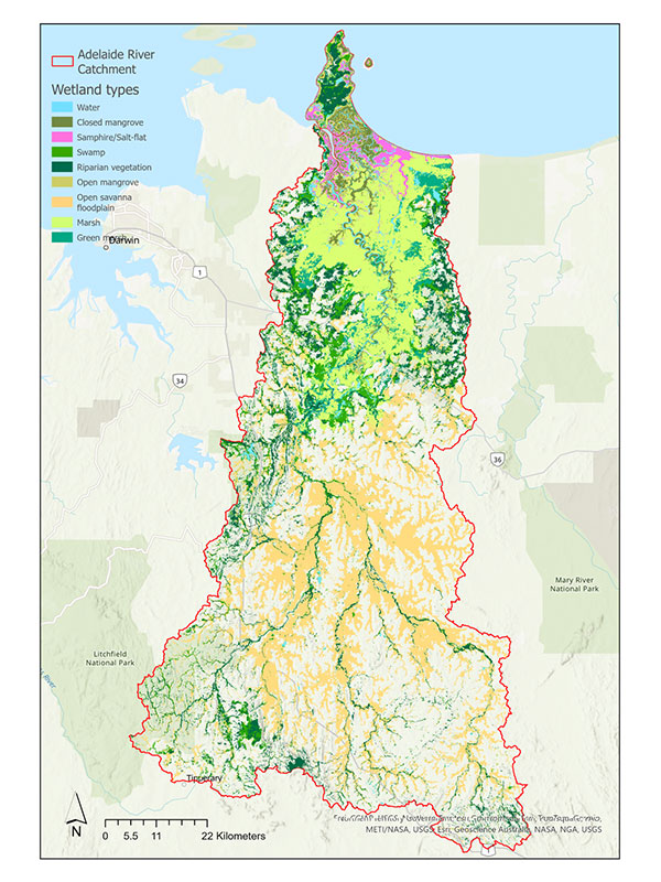
The Department of Lands, Planning and Environment has undertaken a Mapping and Classification of Aquatic Ecosystem project in the Adelaide River catchment, in partnership with Charles Darwin University.
The Adelaide River coastal floodplains are nationally and internationally significant. Wetlands and floodplain ecosystems play a critical role in supporting biodiversity and providing vital ecosystem services, such as maintaining water quality and habitat for a diverse range of species, including migratory birds and native fish. Understanding natural variations in floodplain conditions is essential for managing the impacts of land use changes, climate change, and water extraction.
This project, funded by the National Water Grid Authority and led in partnership by the Department of Lands, Planning and Environment and Charles Darwin University (CDU), is providing baseline data to support the development of a water allocation plan for the Adelaide River. This research focuses on understanding seasonal variations in flow on the river’s floodplains, classifying aquatic vegetation types and providing preliminary information on the condition of the aquatic habitats.
River flow in the Adelaide River shows significant seasonal variations, which directly influence the extent and duration of flooding. This in turn affects the hydrological connectivity of the floodplains, including:
- Longitudinal connectivity (flow along the river),
- Lateral connectivity (spread of water onto the floodplains)
The CDU project is using innovative tools to map wetlands and water features across the Adelaide River catchment including Landsat images and topographic metrics (elevation, slope, and height) in the Google Earth Engine platform. This mapping framework incorporates data from 1986 to 2022, capturing the seasonal fluctuations in water availability and their effects on the region's aquatic habitats.
The information gathered through this project will help inform the water allocation plan, ensuring that water extraction during the wet season is balanced with the need to protect the river’s ecological health. By understanding the dynamic nature of the river’s flow and the connectivity of the floodplains, the plan will support sustainable water management practices for both the environment and water users.

