

Regional Ecosystem And Landscape Mapping Framework
The framework is a hierarchy with 5 levels of mapping and a sixth level to represent the on-ground detail.
- Level 1 – REALM Regions - these are broad regional areas of related geology and geomorphology.
- Level 2 – Subregions - the subregions identify representativeness, transitional areas, inliers, and outliers at a broad level. They represent the first level of variation within a region.
- Level 3 - Ecosystem/landscape aggregations - this is an intermediary level that distinguishes aggregations of landscape features to highlight their geographical and ecological significance as well as emphasise their distinctiveness or peculiarity within their respective landscape settings.
- Level 4 – Ecosystem/landscape association - groupings of related level 5 units that fit within a broader discernible landscape feature and can be separated from adjoining landscapes.
- Level 5 - Landscape and ecosystem map units classified from integrated geomorphic landform, vegetation and soil data.
- Level 6 - Field sites or delimited sample areas in the landscape selected for measuring and capturing ecological and landscape information. While these have a spatial extent, they are not mapped but inform the mapping levels.
Level 1 - REALM Regions
The REALM Regions make up level 1 of the framework and are based on the ‘enduring’ components of the ecosystems, namely geomorphology (geology and associated landforms) within a geographical context. These geomorphic characteristics do not change appreciably over ecological time, and the boundaries are coincidental with other ecological parameters such as vegetation and soil.

Figure 1 - map of NT REALM Regions level 1, version 1.1.
Level 2 - Subregions
The subregions provide the initial broad level opportunity to represent regions of related landscape features as well as variability. They are commonly related by geomorphology as well as different landscape forming processes. They allow for a pragmatic broad-level comparison of landscapes both within a region and across the regions.

Figure 2 - example of level 2 subregions in Pine Creek region.
Level 3 - Ecosystem/landscape
This is an intermediary level that distinguishes aggregations of landscape features to highlight their geographical and ecological significance as well as emphasise their distinctiveness or peculiarity within their respective landscape settings.

Figure 3 - example of level 3 regions in Pine Creek region.
Level 4 – Ecosystem/landscape associations
Level 4 – associations are groupings of related level 5 units that fit within a broader discernible landscape feature and can be separated from adjoining landscapes. They are comparable to land systems but are derived by amalgamating level 5 units. The land systems will provide an interim level 4 alternative until this process is more established.
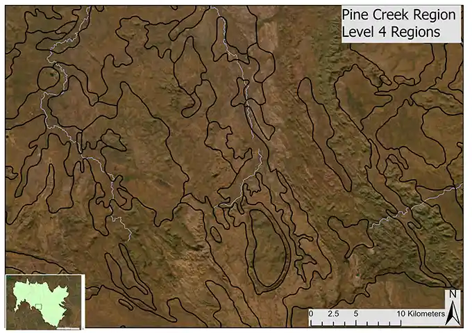
Figure 4 - example of level 4 regions in Pine Creek region.
Level 5 – Ecosystem/landscape unit
Level 5 – landscape and ecosystem map unit derived and classified from integrated geomorphic landform, vegetation, soil and additional relevant ecological information.
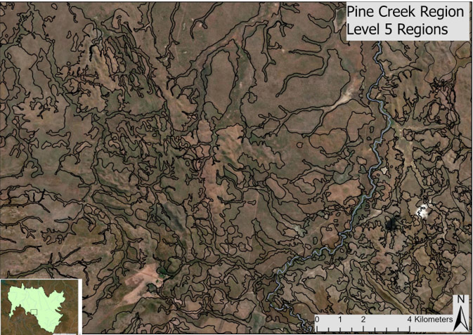
Figure 5 - example of level 5 regions in the Pine Creek region.
Level 6 – Field data and information
Level 6 - field data and ancillary information such as geology, elevation and remote sensing inform the mapping for level 5 and above. Level 6 provides the basis for the REALM map unit classification and includes a ‘geomorphic’ landscape description, a vegetation class description and soil classification.
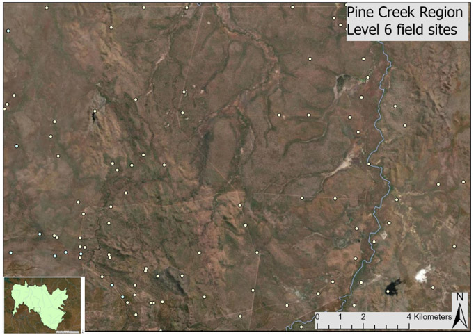
Figure 6 - example of level 6 field sites in the Pine Creek region.
Give feedback about this page.
Share this page:
URL copied!