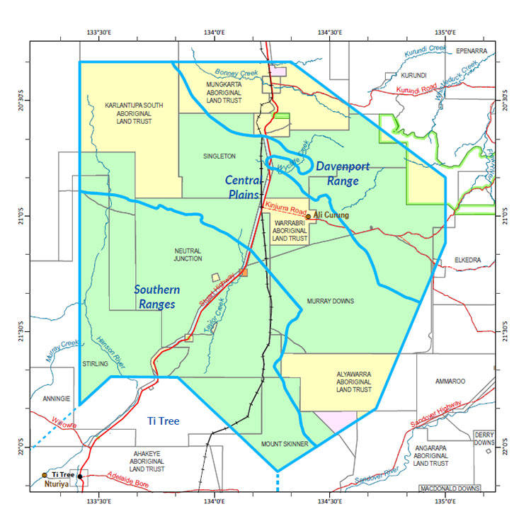
Western Davenport
In 2015-16, the Department of Environment and Natural Resources undertook a soil and land suitability assessment in the Ali Curung area in parallel with a review of the Western Davenport water allocation plan.
The soil and land suitability assessment investigated 47,610 ha across pastoral and Indigenous land, and identified more than 43,840 ha of land suitable for a range of irrigated agricultural crops.
The current water allocation plan identifies an estimated sustainable yield for groundwater of 168,405 ML per year, with 30,000 ML per year allocated to the environment and non-consumptive cultural use and 138,405 ML per year available to be shared amongst consumptive users.
In recognition of growing interest to undertake further irrigated horticultural development in the Western Davenport area, further studies are underway to better understand groundwater availability and biodiversity assets in the area.
Improved mapping of depth to groundwater and knowledge of existence and requirements for protection of groundwater dependent ecosystems (GDEs) are required to inform water allocation decisions and provide confidence in long term water availability.
More extensive mapping of the soil and land capability is also required to support development expansion.
A desktop soil and land suitability assessment, biodiversity and GDE surveys and groundwater drilling in the area has been undertaken to address these knowledge gaps. For more information about the report, go to the Northern Territory Government website.
Integrating these products has provide a comprehensive overview of the biophysical resources within the area and has informed development of the Western Davenport Water Allocation Plan.
Biodiversity
The following report documents the results of fauna and flora surveys within the Western Davenport area, including occurrence and distribution of threatened species, significant habitat and biodiversity risk classes.
- Read the report (pdf) on the Territory Stories website.
- Read the associated Ecological characteristics of potential groundwater dependent ecosystems report (pdf) on the Territory Stories website.
- Download the spatial data package (contains data, metadata and reports).
- View the metadata record.
Water
Read more information related to water allocation in the Western Davenport district:
- Read the Western Davenport Water Allocation Plan 2024-2027.
- For more information on existing water licences in the area, go to the water licensing portal.
- Download the groundwater in the Western Davenport map.
- Download the spatial data package.
- Read the metadata. go to the NTLIS website.
Contact
For further information, contact:
Simon Cruickshank
Phone: 08 8999 3676
Email: simon.cruickshank@nt.gov.au
Give feedback about this page.
Share this page:
URL copied!
