East Arnhem
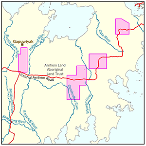
Soil and land suitability mapping has been carried out across four survey areas in East Arnhem Land.
The department is awaiting formal endorsement from the Northern Land Council and Traditional Owners before public release of the:
- spatial datasets
- mapping products and
- technical report.
Until the department receives formal endorsement, public requests for these datasets and associated products must be accompanied by written approval from the Northern Land Council.
View survey location on NR Maps.
Contact
For further information contact rangelands@nt.gov.au

View a larger version of the East Arnhem locality map.
Give feedback about this page.
Share this page:
URL copied!