Katherine flood mitigation
The Northern Territory Government is delivering the Katherine flood mitigation project.
Flood modelling has identified levee banks and upgraded drainage will provide the greatest reduction in flood impact for the smaller flood events; to better protect Katherine properties.
The embankment and wall levees, which form part of the structural mitigation recommendations from the Katherine Region Flood Mitigation Advisory Committee's report, will:
- increase Katherine's flood resilience
- improve flood protection of Katherine residential areas in flooding events up to a 1-in-20 year event.
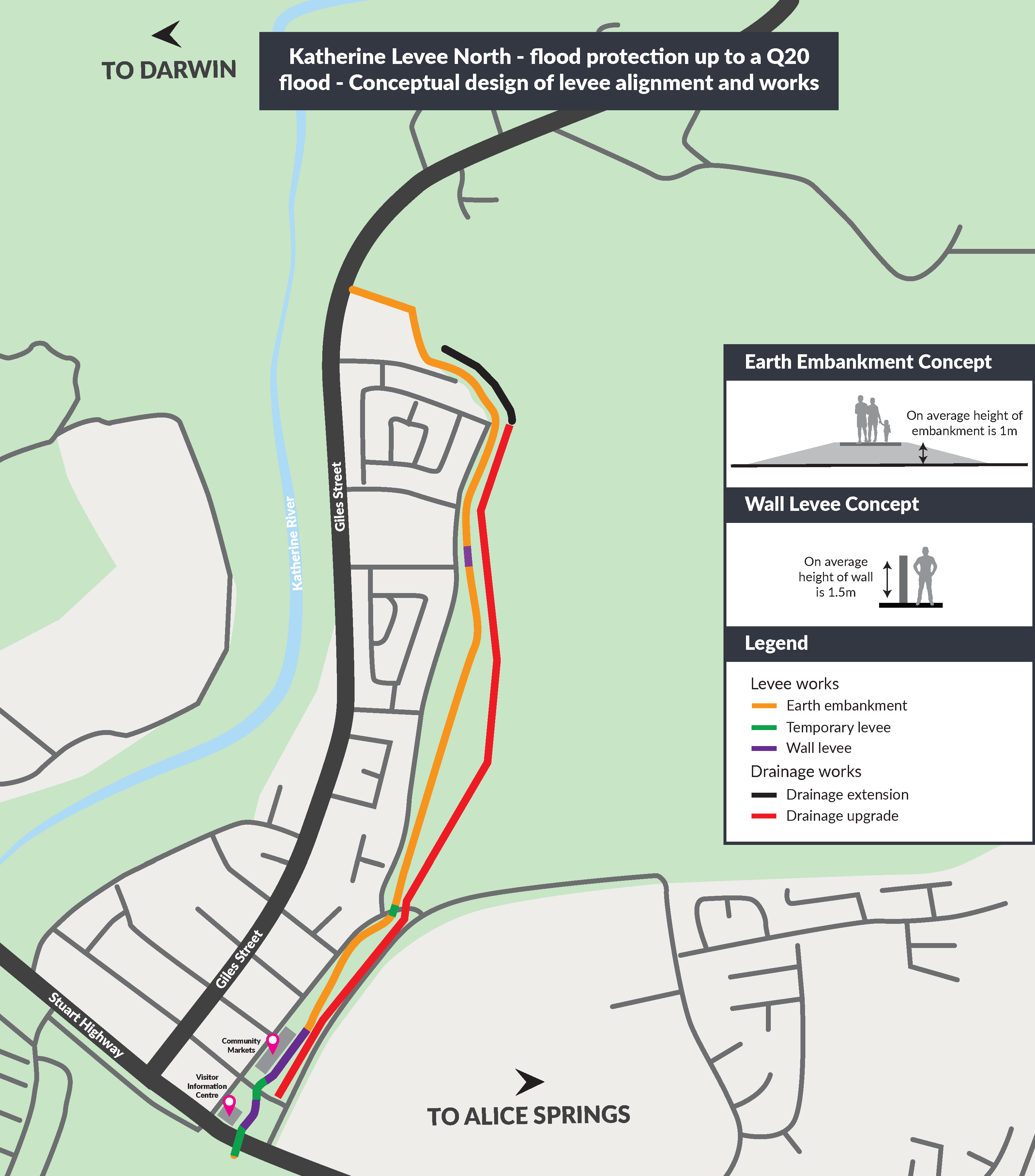
The northern section flood levee (Stage 1 - Complete):
- runs from the northern side of Knotts Crossing Resort and Caravan Park, near the old Katherine Airstrip to the Stuart Highway.
- prevents overflows from Lockheed Drain during the 20-year (72-hour) flood event.
The southern section flood levee (Stage 2) will:
- run from the Katherine Country Club along the eastern side of South Katherine to the southern tip of South Katherine.
- prevent overflows from Tindal Creek during the 20-year, 18-hour, flood event.
Detailed design works and construction of structural mitigations are a component of the broader project, which also includes provision of town planning measures for alternative commercial land outside of the flood zone in Katherine East.
In 2018, the Department of Infrastructure, Planning and Logistics conducted extensive community consultation, with the feedback being considered and incorporated into the scope for the detailed design contract.
View flood mitigation projects being delivered across the Territory.
Maps/Concept images
Stage 1 works, the Northern Section PDF (104.7 KB).
For the floodplain modelling and mapping for Katherine, go to the NT Government website.
Previous announcements
- Construction Tender Release for Katherine Flood Mitigation Works - media release - 12 May 2021
- Protecting Katherine's future: contract awarded for Katherine flood mitigation design - media release - December 2019
Contact
Project Manager: Jasmine Husson
Email: flood.mitigation@nt.gov.au
Give feedback about this page.
Share this page:
URL copied!
